The River
A brief description of the Ipswich River, courtesy of the Ipswich River Watershed Association:
So, what is the Ipswich River Watershed, anyway? The Ipswich River is a small, lovely coastal river in northeastern Massachusetts, which flows a meandering course of about 45 river miles from its source to the sea. Its watershed is all the land which “sheds water,” or drains, into the Ipswich River. Beginning in headwater streams in eastern Middlesex and northeastern Essex Counties, the watershed includes all or part of 21 communities.
The watershed is more than just land which drains into a river, though. It is also a large and complex ecosystem. Water is the element which brings the land to life, and connects all the natural and human communities.
The Ipswich River connects 21 communities in northeastern Massachusetts, flowing from headwaters in Wilmington and North Andover through the towns of Reading, North Reading, Middleton, and Topsfield before reaching the sea at Ipswich. It winds through low hills, meadows, and wetlands and gathers water from dozens of tributary streams over a 155 square mile watershed area before emptying into Plum Island Sound and the Gulf of Maine. The river’s estuary is part of the Great Marsh, an extensive salt marsh ecosystem widely recognized for its outstanding ecological, economic and recreational value, and the Parker River/ Essex Bay Area of Critical Environmental Concern, one of the most important shellfish areas in the state. The Ipswich River provides outstanding recreational opportunities for fishing, canoeing, and birdwatching, and is the lifeblood of the Essex National Heritage Area, federally designated because of the region’s unique historic, cultural and natural resources. Our Ipswich clams are famous nationwide.
The Ipswich River and its watershed have supported a rich, diverse ecosystem for thousands of years. This small river graces the region, providing outstanding habitat for myriad creatures which live here. In the early 1600′s, Captain John Smith was so awed by the river’s bounty that he called this the “land of promise.” Today, minks, otters, fishers, seals, bitterns, harriers, least terns, wood ducks, wild turkeys, barred owls, spotted turtles, wood frogs, brook trout, river herring and striped bass are some of the creatures you might see on a trip from source to sea. Substantial portions of the watershed are state-designated as critical habitats because of the rare species and exemplary aquatic habitats they contain.
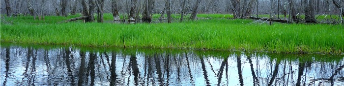
The Ipswich River Watershed includes some of the most outstanding scenery in Massachusetts, both inland and along the coast. The landscape of low glacially-formed hills blanketed with pines, oaks, maples, ash and other trees, has been shaped over millennia by the Ipswich River and its tributary streams. The region’s agricultural past is still in evidence, with farm fields and tracts reclaimed by forest, bordered by classic New England stone walls. Swamps dominated by red maple, Atlantic white cedar, buttonbush, alder, highbush blueberry and many other wetland plants play a key role in the region’s ecology, and their protection helps retain the region’s natural beauty. Many ponds and lakes provide the dance of light upon water so many of us love – and places to swim, fish and canoe, to boot.
The Ipswich River is what connects all these parts of the landscape into an ecological whole. The river system is also the source of drinking water for more than 330,000 people in 14 communities – one of the most important natural resources in Massachusetts.
For more information the Ipswich River, as well as fun ways to enjoy it, check out the Ipswich River Watershed Association website here.
Thunder Bridge to Rowley Bridge Road

This leg of the project stands as a connector leg between the Middleton portion of the river and all the beautiful sites downstream in Topsfield and Ipswich. After departing from the Thunder Bridge parking lot, you travel through the woods off of East Street before passing under interstate 95. From here you travel through a large floodplain and past Masconomet Regional High School. The river swerves through the floodplain before joining up and then travels down to Rowley Bridge Road.
Rowley Bridge Road to High Street
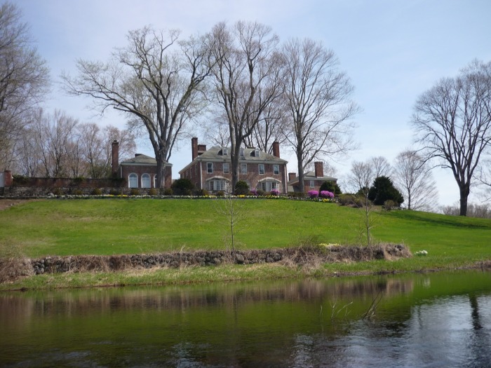
This is one of the most beautiful legs in the entire project. After leaving from the launch at Rowley Bridge Road, you travel past immense estates and extensive farmland on both sides of the river. You will be passing under a historic pedestrian bridge and by various floodplain areas. After traveling under the Salem Road bridge, you will voyage past the Topsfield Fairgrounds and protected conservation lands before coming to the launch on High Street.
High Street to Perkins Island
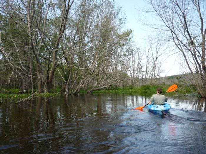
During this leg of the trip, you will enter into the vast and protected lands of the Ipswich River Wildlife Sanctuary. After departing from the launch on High Street, you will travel past a large floodplain area before traveling under the bridge on High Street. From here you will enter the wildlife sanctuary. During the rest of the leg, you will travel through protected lands, past and through large floodplain areas , and witness first hand some of the wildlife species that make their home in or near the river. Before too long you will hit Perkins Island on the right hand side heading downstream.
Colt Island to Ipswich Road
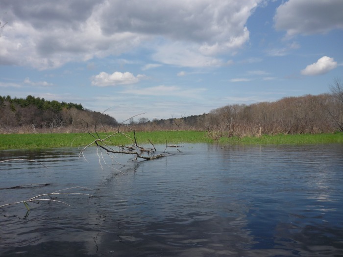
This is the longest leg within the project. After departing from Colt Island, you will enter one of the largest meadows on the Ipswich River. The meadow has many twists and turns, plus an abundance of fish and bird species. There will be many smaller islands along the way, although most are privately owned with no trespassing allowed. After about two miles traveling through this meadow you will come out to the bridge at Asbury Street (small landing). From here you will enter the protected lands of Bradley Palmer State Park before hitting the launch on Ipswich Road.
